Using Upstream LIDAR Measurements
- $393k Funded by ARENA

- $813k Total project cost

Summary
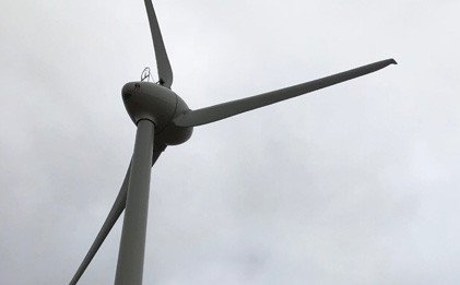
In this Using Upstream LIDAR Measurements project, Windlab will use upstream LIDAR wind profile measurements to augment (supervisory control and data acquisition) SCADA information currently provided to the machine learning algorithms used in 5-minute-ahead wind forecasts.
This project involves using LIDAR wind profilers to map out the best locations to take upstream measurements and the extent to which those upstream measurements can increase the accuracy of 5-minute-ahead wind forecasts.
Key results
Windlab used two LIDARs to measure wind upstream of the windfarm to determine whether these measurements could improve upon AEMO’s own forecast. This project was very experimental in its nature. The anticipated follow-on from the work would have been a forecasting tool/product based on the methodology. Though it was found that inclusion of upstream wind measurements increased forecast performance, in the final stages of the project it was determined that the increase in accuracy of the forecasts were not sufficient to warrant further development of a forecast system based on the methodology.
Learn more
Report: LIDAR for Wind Forecasts End of Project Report
This is the final report for the Windlab Limited – LIDAR for Wind Forecasts Project.
Report: LIDAR for Wind Forecasts Lessons Learnt 2
This Lessons Learnt Report outlines the key from the period between October 2019 – April 2020.
Report: Short-Term Forecasting Trial on the NEM Progress Report
This report presents a summary of the insights and progress from initial reports submitted by the 11 participants of the Short-Term Forecasting (STF) trial that is taking place between March 2019 to mid 2021.
Report: LIDAR for Wind Forecasts Lessons Learnt 1
This Lessons Learnt Report outlines the key from the period between April 2019 – October 2019.

Media Release: $9 Million Funding to Enhance Short Term Forecasting of Wind and Solar Farms
Solar and wind farms will trial providing their own short-term generation forecasts, under a funding initiative by ARENA in partnership with AEMO.
How the project works
Windlab will install two LIDARs with portable remote power supplies in areas with quite different wind climates – one at their Kiata Wind Farm in Victoria and the other at Kennedy Energy Park in Queensland. The LIDARs will measure profiles of the wind speed and direction at 1-minute intervals. The LIDAR installations will use long-distance WiFi links to the respective wind farm SCADA systems to provide upstream measurements to be fed into the forecasting algorithms used in 5-minute-ahead wind forecasts.
The LIDARs will be moved periodically to locations determined using upstream probability projection maps, based on the measured wind climate. At each of these locations, the sensitivity of the forecasting algorithms to the upstream measurements will be determined and validated against expected values. The outcome of this exercise is intended to be a validated map of the strongest areas of sensitivity of 5-minute-ahead forecasts to upstream measurements. This in turn will provide a plan for where inexpensive permanent measurement can be located surrounding the wind farm to provide the most accuracy benefit for the least cost of additional measurements.
Area of innovation
The scientific literature contains a number of examples of the use of forward-looking LIDARs to forecast upstream variations in the wind speed and direction. These LIDAR’s are aimed horizontally and provide an upstream picture/slice of the approaching flow – essentially a deterministic approach. The ideal installation of this type would have a LIDAR on the nose of each wind turbine, an extremely expensive prospect.
Here we are deviating from the above in two main ways. The first is that we are looking at the vertical structure of the atmosphere at a number of points (in contrast to a horizontal slice of information at a single level) and using that information in statistical/machine learning algorithms to increase the accuracy of 5-minute-ahead wind forecasts.
The second and related way is that we are aiming to provide a strategy for the placement and operation of a number of inexpensive measurement devices that could be installed in the region surrounding a wind farm. This in turn is expected to lead to a cost-effective way of increasing 5-minute-ahead forecasts and in turn leading reducing causer pays costs.
Benefit
The key to the broad uptake of any method for increasing 5-minute-ahead forecasting accuracy and thereby facilitating increased penetration of renewables (semi-scheduled generation), is economic incentive. In this context that amounts to enabling wind farm operators to make inexpensive measurements – likely to be low mast based ones – that lead to increased forecast accuracy and commensurate reductions in causer pays fees.
Additional impact
In this project Windlab intends to develop a methodology for positioning inexpensive upstream measurements in a way that maximises their effectiveness at increasing 5-minute-ahead wind forecasts. If the economics of implementing these measurement capabilities are attractive in the context of sufficiently reducing causer pays fees, Windlab intends to use the methodology in managing the assets under its management. Another avenue would be to offer a range of services based on the methodology. These could range from placement advice to full turn-key installations and SCADA integration of upstream measurements and potentially a full forecasting service.
ARENAWIRE Blogs
Wind and solar forecasting trial looks into the future
A trial of forecasting technology has been launched to help predict the future output from wind and solar farms, which varies depending on the weather and time of day.
